Trip Report: Pine Ridge Trail, Red Rock Canyon National Conservation Area, Nevada
When: 7/18/2018
Location: Pine Ridge Trail, Red Rock Canyon National Conservation Area
Conditions: Hot, dry, and exposed.
Duration: 2 hours. 2.4 miles each way.
Difficulty: Moderate.
Kid Friendly: Yes, but need to start in the early morning to avoid heat!
Pet Friendly: Yes
Usefull links: www.redrockcanyonlv.org
 The Full Report:
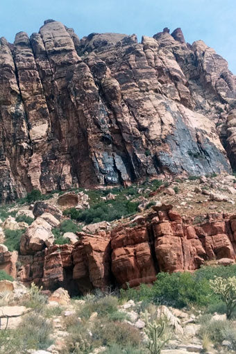
I was able to take a relaxing, albeit too short, mini-vacation in July with my younger brother to visit my Dad and Grandma in Las Vegas, Nevada. Despite traveling to LA, universal studios, and touring Santa Monica pier on classic California Cruzers days before, I found myself most looking forward to visiting Red Rock Canyon National Conservation Area. Not only is the area famous for its beautiful and rich red appearance from iron banding and oxidation within the towering rock formations, it also boasts terrific climbing areas for sport climbers and boulderers alike. The point of my visit to Red Rocks was a need to unplug and experience peace away from the craziness with family. So, I jostled my younger brother awake at 6am to hurriedly eat breakfast, get lectured by my anxious Italian grandmother about the dangers of heat exhaustion, and avoid any morning traffic.
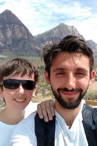
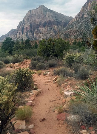
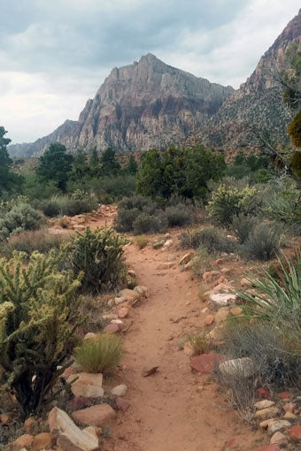
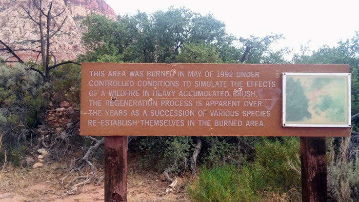
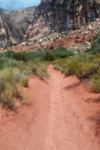 My brother Logan and I arrived at the park around 7ish and were greeted by a park ranger and a $15 fee for parking and visiting the trails for the day. The visitors center didn't open until 9am, so we headed straight to Pine Ridge Trail. The trail was 2.4 miles in and out, and with the heat encroaching, it was 80 degrees even at 7:30am, we grabbed our water and snack-stuffed pack and started the hike. Although Red Rock is in a desert environment, the trail was full of vegetation that surrounded us as we walked along the red dirt path. Many of the trails are fed by underground springs which give rise to a surprising amount of plants and wildlife. As we continued, the desert foliage became more and more dense, with some grass meadows and larger juniper trees. After about a half-mile of hiking, we came upon a side trail labeled "Fire Control Trail." We decided to explore and noticed signage that indicated that the patch of land the trail meandered through had been used in controlled burn experiments. The experiments were designed to test the recovery rate of wildlife and vegetation. Oddly enough, there was some of the densest foliage in this area despite the burn administered in 1974.
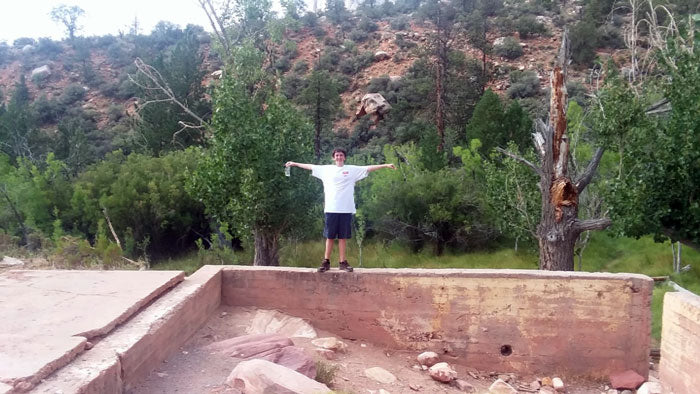
 After looping back to our original trail, we trekked on for another mile and found what used to be an old homestead or rather the original foundation of the homestead. The concrete remains of the basement survived, and you could walk like a trapeze artist along its cement boundaries. The heat had gotten very intense at this point, and the sun was cresting over the mountains. We decided not to dilly-dally any longer and kept on truckin' through the hike. Although signage had been consistent before this point, some "social" or man-made trails from people walking off trail made it difficult to decipher which path was a part of the hike. After bumbling around and bushwhacking, we thought it best to backtrack and find where we knew the trail was still marked. This decision made it so we didn't fully complete the hike, but with heat concerns and no intention of getting lost, we headed back to the parking lot.
 By this point, we were drenched in sweat and sun-beaten despite copious amounts of sunscreen on our pasty appendages. We did feel accomplished though, and that's what matters! We ran to the car, blasted the AC, and returned to my Grandma's house all in-time for a lasagna-filled lunch.

 The Full Report:
I was able to take a relaxing, albeit too short, mini-vacation in July with my younger brother to visit my Dad and Grandma in Las Vegas, Nevada. Despite traveling to LA, universal studios, and touring Santa Monica pier on classic California Cruzers days before, I found myself most looking forward to visiting Red Rock Canyon National Conservation Area. Not only is the area famous for its beautiful and rich red appearance from iron banding and oxidation within the towering rock formations, it also boasts terrific climbing areas for sport climbers and boulderers alike. The point of my visit to Red Rocks was a need to unplug and experience peace away from the craziness with family. So, I jostled my younger brother awake at 6am to hurriedly eat breakfast, get lectured by my anxious Italian grandmother about the dangers of heat exhaustion, and avoid any morning traffic.

 My brother Logan and I arrived at the park around 7ish and were greeted by a park ranger and a $15 fee for parking and visiting the trails for the day. The visitors center didn't open until 9am, so we headed straight to Pine Ridge Trail. The trail was 2.4 miles in and out, and with the heat encroaching, it was 80 degrees even at 7:30am, we grabbed our water and snack-stuffed pack and started the hike. Although Red Rock is in a desert environment, the trail was full of vegetation that surrounded us as we walked along the red dirt path. Many of the trails are fed by underground springs which give rise to a surprising amount of plants and wildlife. As we continued, the desert foliage became more and more dense, with some grass meadows and larger juniper trees. After about a half-mile of hiking, we came upon a side trail labeled "Fire Control Trail." We decided to explore and noticed signage that indicated that the patch of land the trail meandered through had been used in controlled burn experiments. The experiments were designed to test the recovery rate of wildlife and vegetation. Oddly enough, there was some of the densest foliage in this area despite the burn administered in 1974.
 After looping back to our original trail, we trekked on for another mile and found what used to be an old homestead or rather the original foundation of the homestead. The concrete remains of the basement survived, and you could walk like a trapeze artist along its cement boundaries. The heat had gotten very intense at this point, and the sun was cresting over the mountains. We decided not to dilly-dally any longer and kept on truckin' through the hike. Although signage had been consistent before this point, some "social" or man-made trails from people walking off trail made it difficult to decipher which path was a part of the hike. After bumbling around and bushwhacking, we thought it best to backtrack and find where we knew the trail was still marked. This decision made it so we didn't fully complete the hike, but with heat concerns and no intention of getting lost, we headed back to the parking lot.
 By this point, we were drenched in sweat and sun-beaten despite copious amounts of sunscreen on our pasty appendages. We did feel accomplished though, and that's what matters! We ran to the car, blasted the AC, and returned to my Grandma's house all in-time for a lasagna-filled lunch.

