Trip Report: Angel’s Rest Hike in the Columbia River Gorge
When: 05/14/2019
Location: Angel’s Rest, Columbia River Gorge, OR
Conditions: Sunny and warm
Duration: 2.5 hours
Distance: Between 4.5 and 5 miles roundtrip
Trail Format: Out-and-back
Difficulty: Moderate, with a small scramble at the top. I did the hike in sandals.
Kid Friendly: Yes, although it’s likely most suitable for those eight and older
Dog Friendly: Yes, provided they’re good with heights and rocks
 The Full Report:
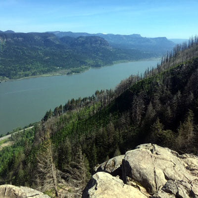
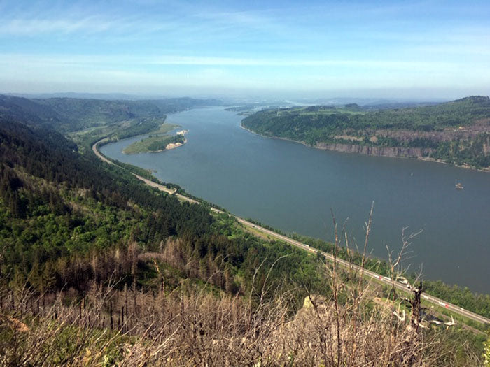
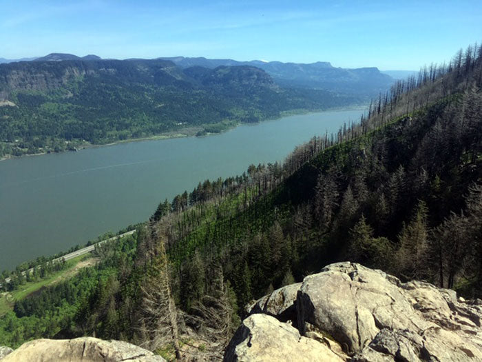
In the twenty years that I’ve lived in Portland, I’ve hiked Angel’s Rest more times than I can count. It’s a mere 40-minute drive from town yet offers varied terrain and incredible views of the Columbia River Gorge. It had been my go-to, showcase hike for visiting friends for years. Then, in 2017, the Eagle Creek Fire forced the closure of a majority of the Gorge’s trails, Angel’s Rest among them. Although Angel’s Rest re-opened in November 2018, I didn’t return until May 2019. It was the first time that I’d hiked in the Gorge post-fire, and I was anxious to see the extent of the damage. Honestly, the place looks great. Due in large part to extensive restoration efforts, the trail looks almost exactly as I remember it. The burn areas look verdant, healthy, and well on their way to recovery. For those like myself who worried that the fire had wiped out our favorite Gorge spots: don’t. They’ll be just fine.
There are two ways to reach the Angel’s Rest trailhead from Portland: take I-84 E, then get off at Bridal Veil (exit 28); or take I-84 E, then take the Historic Columbia River Highway (accessible from Troutdale, east). If you have a little extra time and don’t mind narrow, winding roads, beautiful forest, and roadside fruit stands, take the Columbia River Highway. Parking can be limited at the trailhead, though it’s generally easy to find space on weekday mornings.
 The trail itself begins with a mild uphill through quiet, old-growth forest. The grade increases marginally as the trail turns away from the road, though it never becomes exceptionally steep. After about a half mile you’ll hear Coopey Falls, a tall, horsetail waterfall fed by Coopey Creek. There is a trail spur at the first obvious rest point that terminates at the top of the falls and offers a pleasant view of the creek.
The route continues alongside Coopey Creek for a short distance before crossing a footbridge and becoming marginally steeper. After a brief jaunt in the trees, it emerges onto a semi-exposed ridge face, providing your first true glimpse of the Gorge. The trail continues to wind in and out of the woods as it climbs, passing numerous burn areas.
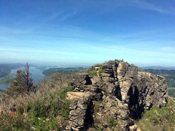
The path ultimately appears to terminate at a boulder. At this point it’s possible to climb atop a minor outcropping to the south (for those interested in a longer hike/possible backpacking trip: this trail continues into the Mark O. Hatfield Wilderness and Mount Hood National Forest), or scramble up a minor boulder problem to the north. Going north offers classic, sweeping views of the Gorge, Portland, numerous surrounding mountains, and Bonneville Dam. There is a wide, flat area to explore and rest, but no handrails or paved portions. Enjoy the expanse, but watch your step.

 The Full Report:
In the twenty years that I’ve lived in Portland, I’ve hiked Angel’s Rest more times than I can count. It’s a mere 40-minute drive from town yet offers varied terrain and incredible views of the Columbia River Gorge. It had been my go-to, showcase hike for visiting friends for years. Then, in 2017, the Eagle Creek Fire forced the closure of a majority of the Gorge’s trails, Angel’s Rest among them. Although Angel’s Rest re-opened in November 2018, I didn’t return until May 2019. It was the first time that I’d hiked in the Gorge post-fire, and I was anxious to see the extent of the damage. Honestly, the place looks great. Due in large part to extensive restoration efforts, the trail looks almost exactly as I remember it. The burn areas look verdant, healthy, and well on their way to recovery. For those like myself who worried that the fire had wiped out our favorite Gorge spots: don’t. They’ll be just fine.
There are two ways to reach the Angel’s Rest trailhead from Portland: take I-84 E, then get off at Bridal Veil (exit 28); or take I-84 E, then take the Historic Columbia River Highway (accessible from Troutdale, east). If you have a little extra time and don’t mind narrow, winding roads, beautiful forest, and roadside fruit stands, take the Columbia River Highway. Parking can be limited at the trailhead, though it’s generally easy to find space on weekday mornings.
 The trail itself begins with a mild uphill through quiet, old-growth forest. The grade increases marginally as the trail turns away from the road, though it never becomes exceptionally steep. After about a half mile you’ll hear Coopey Falls, a tall, horsetail waterfall fed by Coopey Creek. There is a trail spur at the first obvious rest point that terminates at the top of the falls and offers a pleasant view of the creek.
The route continues alongside Coopey Creek for a short distance before crossing a footbridge and becoming marginally steeper. After a brief jaunt in the trees, it emerges onto a semi-exposed ridge face, providing your first true glimpse of the Gorge. The trail continues to wind in and out of the woods as it climbs, passing numerous burn areas.
The path ultimately appears to terminate at a boulder. At this point it’s possible to climb atop a minor outcropping to the south (for those interested in a longer hike/possible backpacking trip: this trail continues into the Mark O. Hatfield Wilderness and Mount Hood National Forest), or scramble up a minor boulder problem to the north. Going north offers classic, sweeping views of the Gorge, Portland, numerous surrounding mountains, and Bonneville Dam. There is a wide, flat area to explore and rest, but no handrails or paved portions. Enjoy the expanse, but watch your step.


